|
<< Click to Display Table of Contents >> Import Data - SAR Spaceborne - SAOCOM-1 |
  
|
|
<< Click to Display Table of Contents >> Import Data - SAR Spaceborne - SAOCOM-1 |
|
Preliminary details
The import process has been validated using a limited dataset. Gound Control Point are recommended to correct orbital errors (mostly occurs in slant range direction). In case of unavailability of GCPs, the automatic orbit correction is recommended.
Purpose
Standard products, acquired by any of the SAOCOM-1 constellation satellites, are imported into the SARscape Data Format for further processing.
Technical Note
The import functionality requires only the input Parameter file(s) to be entered. The relevant data type is automatically identified.
In case the input is a list of files, all products must be of the same type (refer to the "Supported Products" section).
Supported Products
| SLC | stripmap, single look, complex, slant range |
| GEC | Ellipsoidal Geocoded |
| DI | Detected Image (ground range projected) |
Further information at https://saocom.veng.com.ar/en/
Input Files
Input file list
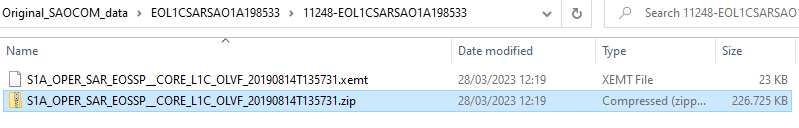
Input file name(s) of the .zip folder extracted from the original data (.zip folder), the .xemt file has to be included. An example of the folder tree is reported in the screenshot below:
These files are mandatory.
Parameters - Principal Parameters
Polarization
This option let to choose which polarization should be imported in case the original data contains more than 1 polarization. Options are: All, Copolarization (VV or HH) and Crosspolarization (VH or HV). This is helpful in case of only one polarization is needed (e.g. only copolarization for interferometry purposes) reducing the time of the import and the space on disk needed.
Fill dummy during import
Possibility to replace invalid backscatter pixel values with random low values.
Rename Output Using Parameters
If this option is not set, the output files will be placed in the output directory with the root name which appears in the Output File List
If this option is set (recommended), the output files will be placed in the output directory with an automatically generated root name, assigned based on the input file parameters.
Parameters - Global
It brings to the general section of the Preferences specific parameters. Any modified value will be used and stored for further processing sessions.
Parameters - Other Parameters
It brings to the general section of the Preferences parameters. Any modified value will be used and stored for further processing sessions.
Output Files
Output file list
Output file name(s) of the imported data. These files are mandatory.
Root name of the imported file(s) and associated header files (.sml, .hdr). Specific file suffixes are added according to the data type.
.shp
Shape file and associated header files (.sml, .hdr) containing the image perimeter in geographic co-ordinates.
.kml
ASCII file containing the image perimeter in geographic co-ordinates. Double clicking on this file will automatically position the boundaries of the scene into the Google Earth environment.
Details specific to the Units of Measure and Nomenclature of the output products can be found in the Data Format section.
General Functions
Exec
The processing step is executed.
Store Batch
The processing step is stored in the batch list. The Batch Browser button allows to load the batch processing list.
Close
The window will be closed.
Help
Specific help document section.
Specific Function(s)
None.
Task, SARscapeBatch object, SARscapeBatch script example
References None.